Conflict Resolution and Transboundary Water Resources
![]() No. 44, Fall/Winter 1998
No. 44, Fall/Winter 1998
Conflict Resolution and Transboundary Water Resources
by Elaine Moore Hebard
|
"For a binational dialogue to be viable, it must include public participation and community education. This paper details efforts to create such a dialogue in the context of a Southwest Center for Environmental Research and Policy (SCERP) project to create a water quality assessment plan. The proposal was to compile data and characterize the aquifer, and to involve local residents, municipalities, and regional planning bodies in the design, coordination and implementation of the project so as to integrate project results into both communities." |
Publications Distribution Rocky Mountain Research Station 3825 E. Mulberry Street Fort Collins, CO 80524-8597 USA Telephone: +1 (970) 498-1719 FAX: +1 (970) 498-1660 E-mail: rschneider/rmrs@fs.fed.us Introduction[Back to top]Watershed planning requires knowledge of water quantity, water quality, economic activities, social characteristics, and a baseline inventory of natural resources -- all fundamental to designing a workable management regime. In addition to data collection, the process must include initiating a water dialogue that blends technical analysis with public participation. Such a dialogue would help local citizens understand what the resource is, including its present condition and potential, and how they may best conserve and preserve it. Rationale for binational watershed planning[Back to top] |
|
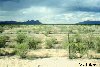
The Mimbres drainage system, a "closed basin," is located in arid southwestern New Mexico and northwestern Chihuahua -- an area receiving approximately 23 cm (9 inches) of rain annually. Two border communities -- Columbus, New Mexico and Puerto Palomas, Chihuahua, bound by historical, familial and economic ties -- depend solely on groundwater for their water. Columbus, located in Luna County, has 650 residents. Puerto Palomas, situated in the Municipio of Ascension, has roughly 10,000 residents. During the last twenty years, the population of Luna County has increased by 55% and of the Municipio by 76%. Agriculture contributes significantly to the social and economic makeup of the area but also accounts for 95% of the withdrawal and the depletion rates from the aquifer. Projected increases in population as well as agriculture and industrial development will only intensify pressure on the already declining water table.(1) Current or potential contamination and alkalization are also concerns, and recent drought has emphasized the need for water conservation. Despite this, the international border has made it nearly impossible for the two communities to jointly manage the aquifer they both depend on, even though such joint management is critical. Adequate mechanisms to deal with this dilemma are lacking. While both the New Mexico State Engineer and the Comisión Nacional de Agua (Mexico's National Water Commission) do plan for their users, each formulates its rates of withdrawal without considering usage on the other side of the border. Furthermore, there is little systematic gathering of data on water characteristics or behavior, and no formal sharing of existing data, much less joint planning for future usage and/or conservation. This lack of information about the aquifer makes it difficult for residents to make rational choices between proposed uses of water and for government agencies to predict the aquifer's carrying capacity. This results in inappropriate policies, renders current unilateral plans useless, hinders impact analysis and impedes the consideration of options. Fostering a binational dialogue is a progressive and necessary step toward achieving a transboundary watershed managment scheme for the Mimbres basin. For a binational dialogue to be viable, it must include public participation and community education (2). This paper details efforts to create such a dialogue in the context of a Southwest Center for Environmental Research and Policy (SCERP) project to create a water quality assessment plan. The proposal was to compile data and characterize the aquifer, and to involve local residents, municipalities, and regional planning bodies in the design, coordination and implementation of the project so as to integrate project results into both communities. Both team consultations and community meetings were planned, so that the questions raised would help guide the research as well as the formulation of the plan, which in turn would address noted local concerns. The objectives for the community meetings were to "disseminate information about ground water to the public, to involve citizens in the decision-making process concerning ground water and to nurture a transborder dialogue on ground water." Initial phase[Back to top]The first task was to design and implement a public participation program for the two border communities. While the shared aquifer created a unifying theme, many differences remained in terms of legal and administrative systems, the level of knowledge, available data, sufficient time to participate, experiences, cultures, etc. Most important, expectations of what public participation means may vary, thus actual participation is likely to as well. Due to the lack of models to follow, the initial program involved identical processes implemented on both sides of the border. These included personal contacts, presentations to officials, informational public meetings and communications with teachers. Preliminary outcomes can be summarized as follows:
Revised work plan[Back to top]After the initial phase, the program was adjusted based on participants' observations and the preliminary outcomes. The work plan was revised to address participants' perceived lack of knowledge. The focus shifted from providing information from the team to the community to providing knowledge concerning the resource in general. Such modifications also meant that the programs were no longer identical in the two communities. The revised work plan targeted specific populations -- parents and retirees in Columbus; parents and officials in Palomas -- in order to involve as many people as possible. Under the new plan, the objectives were to:
|
|
Numerous activities were undertaken during the final phase of the project:
|
|
Many of these activities had promising results. The Water for Life/Agua Para la Vida group was formed in Columbus to educate residents about their water resource; its first project was a seminar on xeriscaping (low water-use gardening) to introduce the subject in a non-threatening forum. The Water Festival drew over 400 attendees with some 15 U.S. and Mexican agencies participating. Approximately 800 students from the local schools prepared posters, models, skits, dances, and a survey of water knowledge in the community. This forum also provided the team with an excellent vehicle to present the full project. A video of the event is evolving into a useful teaching tool. Finally, information about water was disseminated throughout the two communities, especially via school handouts and the festival. Analysis, recommendations and conclusions[Back to top]AnalysisThe team successfully identified concerned groups and individuals and provided all interested parties with access to the process. Different forums were used to encourage involvement. Several communications media were used, and all materials were prepared to be easily understood. Local participants were recruited to take on various assignments. The educational component was successful, as highlighted by the water festival. In accord with the earlier-stated objectives, both the planning preceding the water festival and the desire to hold it annually represent successful steps toward developing a binational discussion. However, little was accomplished as far as enabling residents to discover and share data, give their input on water quality issues, and be involved in designing the plan. To date, participation has not been integral to the planning process. The team did not provide the public with specific information about the aquifer in a timely fashion. Perhaps this was due to conflicting expectations within the team, which had difficulty determining and thus agreeing on what an assessment plan entailed, how various components fit together and what time frame was appropriate. Recommendations
ConclusionsThe most effective means of improving water quality of the water and protecting public health in the border region is through binational coordination and collaboration. Public participation is indispensable when creating a plan. An opportunity is provided for agencies responsible for managing the resource to disseminate information, discover information needs and fill those gaps, and identify additional aspects requiring inquiry and research. Once local citizens become aware of and interested in their watershed, they are more likely to become involved in decision-making as well as hands-on protection and restoration efforts. With local involvement, watershed management builds a sense of community, helps reduce conflicts, and increases the public's commitment to actions needed to meet environmental goals. This project began an educational process by creating and distributing information, obtaining comments, and working within the schools. But that is only the beginning. Without a commitment to engage citizens from both sides of the border, it is unlikely that transboundary planning efforts will flourish. The public participation component was successful as a public outreach service. Unfortunately, the transmission of information to be incorporated into a plan never occurred. Nevertheless, future presentations concerning the project's technical aspects are envisioned. Integration of this information with local and regional governments' efforts to manage the resource remains a fundamental, but unfinished, goal. One year did not provide sufficient time to develop groups committed to ongoing involvement, particularly where there are no final outcomes in sight nor any proprietary interest in the resultant data. Should further information be forthcoming, thus providing further reason to be involved, participants will likely be more interested in continuing their endeavors. Hopefully, as the communities become better informed, a nascent binational dialogue concerning their mutually-shared aquifer will evolve. Working together, the binational area can create solutions to ameliorate increasingly negative impacts. Acknowledgements[Back to top]Funding for this project was provided by the Southwest Center for Environmental Research and Policy (SCERP). Thanks especially to Dr. David Henkel, Ing. Mercado Prez and the teachers and residents of Palomas and Columbus for their invaluable assistance. Endnotes[Back to top]1. Over the past several decades, water levels have been declining on both sides due to overdrafting. Between 1950 and 1970, water levels decreased 120 feet in an area of concentrated irrigation east of Columbus (Harshbarger & Assoc. 1978). Blandford's (1987, 23) study indicated that a source of water for wells in the Columbus area was the "reduced underflow toward the basin's southern boundary." The 1991 Regional Water Plan underscored this situation, noting that "pumpage on this side of the border has reversed the flow direction across the border and induced flow into New Mexico." (Resource Technology 1991, I: 9-3). (Back to text) 2. Public involvement is also consistent with the goals of several relevant agencies and institutions, such as SEMARNAP (the Mexican environmental agency), EPA, the Border Environmental Cooperation Commission (BECC), the New Mexico State Engineer, and the Comision Nacional del Agua. Public participation and education are key elements in both the statutorily created New Mexico Regional Water Planning (72-14-44 NMSA 1978 Comp) and Mexico's Water Advisory Councils (Consejos de Cuencas), mentioned in Article 13 of the National Water Law, enacted in December 1992. (Back to text) 3. The posters were arranged by topic, under headings such as "Why a Plan" and the "Purpose of the Project" on one poster board, and "How does Public Participation and Education Fit into a Plan?," "What We've Done," "Objectives," "Potential Outcomes," "What Can You Do" and "Where You Can Obtain More Information" on another. (Back to text) 4. The survey included questions such as: References[Back to top]Blandford, T.N. and J. Wilson. 1987. Large scale parameter estimation through the inverse procedure and uncertainty propogation in the Columbus Basin, New Mexico. Technical Report. Las Cruces, NM: New Mexico Water Resources Research Institute, New Mexico State University. Harshbarger & Associates, Inc. 1978. Overview report of groundwater basins along the international boundary - New Mexico, United States and Sonora and Chihuahua, Mexico. Preliminary Report prepared for the International Boundary and Water Commission, El Paso, Texas. Resource Technology. 1991. Southwest New Mexico regional water plan. 2 Volumes. Tanski, J.M., A. Hanson, A. Granados O., M.G. Mercado P., D. Henkel and E.M. Hebard. 1997. Water quality assessment plan for Columbus, New Mexico, and Puerto Palomas, Chihuahua. SCERP Project Number: WQ96-5. |
![]()
Elaine Hebard is a graduate student at the University of New Mexico. Her research interests include transborder and water issues, bioregional and watershed planning methods, community participation and education, sustainable development criteria and environmental indicators, and conflict resolution. She can be reached for comment by email at: emhebard@unm.edu.
Southwest Center for Environmental Research and Policy
HTTP://www.civil.utah.edu/scerp/
SCERP is a consortium of five U.S. and four Mexican dedicated to applied environmental research on the U.S.-Mexican border region. Among other information, SCERP's web site includes an abstract of the project upon which the activities described in this paper were based:
Water Quality Assessment Plan for Columbus, New Mexico, and Puerto Palomas, Chihuahua
HTTP://www.civil.utah.edu/scerp/projects/WQ96_5.html
BorderLines 44: Water Quality in the Border Region (online journal)
http://www.zianet.com/irc1/bordline/1998/bl44/bl44.html
Published by the Interhemispheric Resource Center (IRC), BorderLines is a monthly bulletin analyzing environmental, socioeconomic, and political issues in the U.S.-Mexico borderlands. Each issue focuses on a particular topic of interest to borderlands residents.
INCITRA
http://www.zianet.com/irc1/incitra/index.html
Administered by the Interhemispheric Resource Center, INCITRA (Información Ciudadana Transfronteriza/Information for Citizen Transboundary Action)is a borderlands project that serves as a clearinghouse for information and resources related to sustainable development issues in the U.S.-Mexico border region.
As interest in the U.S.-Mexico borderlands region has grown, so has the number of web sites devoted to the region. Many are not directly pertinent to the topic of this article but may contain more general information of interest to its readers. The following two web sites, both excellent starting points, are included with such readers in mind:
Borderlands Environmental Archives
http://www.txinfinet.com/mader/ecotravel/border/borderlands.html
Maintained by environmental journalist Ron Mader, this site is the most comprehensive starting point available for locating environmental information on the U.S.-Mexico borderlands.
Andanzas al Web Latino
http://lib.nmsu.edu/subject/bord/latino.html
Maintained by Molly Molloy of the New Mexico State University library, this site provides access to extensive Internet resources by/for Latino/Hispanic communities in the U.S., with emphasis on the U.S.-Mexico border region.
About the Arid Lands Newsletter