Using geospatial technologies to understand dryland dynamics
![]() No. 51, May/June 2002
No. 51, May/June 2002
Using
geospatial technologies to understand dryland dynamics
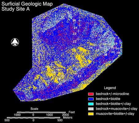 |
Surficial geologic map of a portion of the McDowell Mountains located in central Arizona. Bedrock is Proterozoic quartzite; mineral components identified using linear deconvolution of Thermal Infrared Multispectral Scanner data (Stefanov and Applegarth 2001). |