Using geospatial technologies to understand dryland dynamics
![]() No.
51, May/June 2002
No.
51, May/June 2002
Using geospatial technologies to understand dryland
dynamics
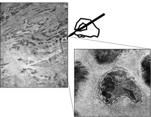 |
This image portrays an imaginary observer identifying an area of this aerial photograph as hardrock, based on its color and shape. It is easy to imagine another observer deciding the "hardrock" area is either larger or smaller. Such differences can add up to wide variations in the total hardrock area estimated by the two different observers of the same photograph. |