Using geospatial technologies to understand dryland dynamics
![]() No.
51, May/June 2002
No.
51, May/June 2002
Using
geospatial technologies to understand dryland dynamics
|
|
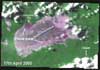
This image, from Robert Bryant's article Monitoring
playa systems using remote sensing: Methods and applications,
was extracted from an Advanced Very High Resolution Radiometer (AVHRR)
time series of |
![]()
About the Arid Lands Newsletter