No. 55, May/June 2004
Fire ecology II
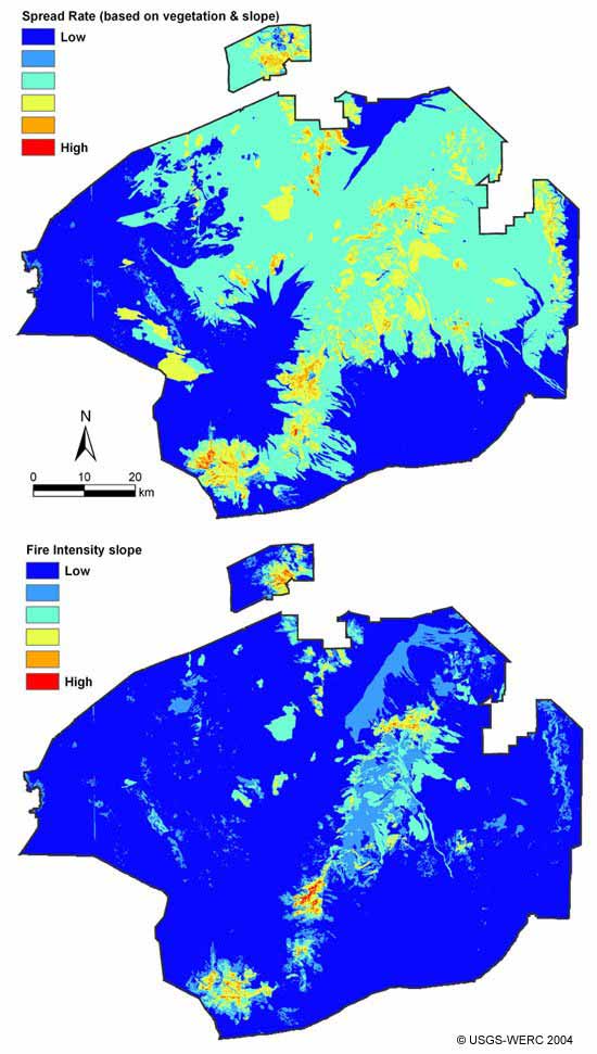
Brooks et al., Fig. 5: Spread rate and fire intensity maps based on vegetation and slope, Mojave National Preserve
[Back to the article text]