No. 55, May/June 2004 Fire ecology II
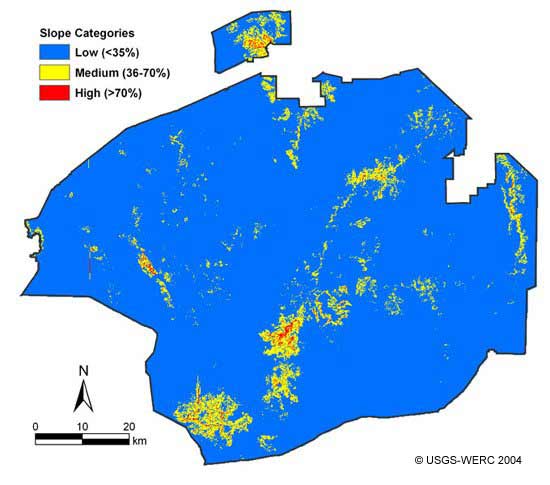
The three slope categories identified within the Preserve and used to generate this map were derived from USGS digital elevation data.
[Back to the article text]