Using geospatial technologies to develop
participatory tools for natural resources management
![]() No. 53, May/June 2003
No. 53, May/June 2003
Using geospatial technologies to develop
participatory tools for natural resources management
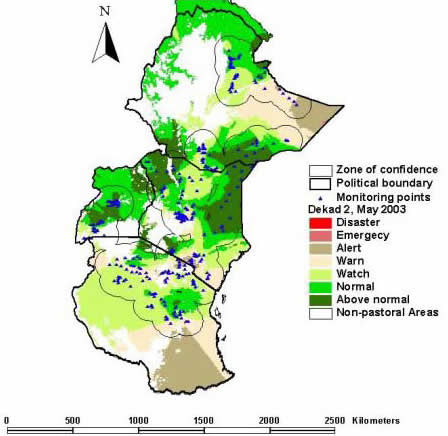
| Currently, there are over 300 monitoring sites across East Africa rangelands that are set up for forage production estimation by the PHYGROW model, as part of the Livestock Early Warning System (LEWS). The map here provides an example of the kind of "regional vegetation response" maps that can be generated by linking the PHYGROW data with spatially rich satellite imagery. |
source: GL-CSRP Livestock Early Warning System (LEWS) |