Using geospatial technologies to understand dryland dynamics
![]() No. 51, May/June 2002
No. 51, May/June 2002
Using
geospatial technologies to understand dryland dynamics
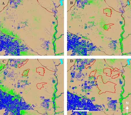
Increased fire frequency has accompanied increased human development in the northeast Phoenix metropolitan region from 1985 to 1998. Fire scars (red polygons) are displayed on a land cover classification base. Time series is 1985 (A); 1990 (B); 1993 (C); and 1998 (D). Land cover types associated with human activities - blue; actively photosynthesizing vegetation - green; undisturbed desert - light brown (Wentz et al. 2001).