Using geospatial technologies to understand dryland dynamics
![]() No. 51, May/June 2002
No. 51, May/June 2002
Using
geospatial technologies to understand dryland dynamics
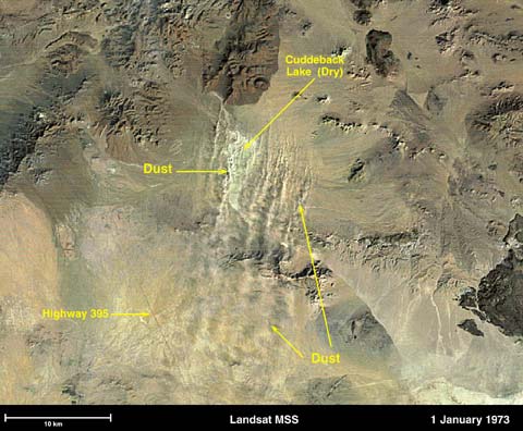
This Landsat Multispectral Scanner image with approximately 80 m resolution shows the spatial distribution of dust sources, relative dust concentrations, and transport patterns visible with a high-resolution image collected during a dust storm without clouds.