Using geospatial technologies to understand dryland dynamics
![]() No. 51, May/June 2002
No. 51, May/June 2002
Using
geospatial technologies to understand dryland dynamics
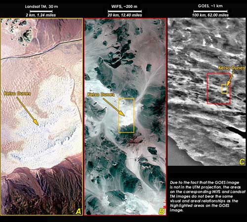
The Kelso Dunes and south Soda Dry Lake area imaged by the Landsat Thematic
Mapper (left), WiFS (center), and GOES (right) satellite-imaging systems,
with spatial resolutions of approximately 30, 200, and 1,000 m for A, B,
and C, respectively. Note the improved textural information in the higher
resolution images; however, their temporal resolutions are 16 and 5 days,
compared with 15 minutes of the GOES image.