|
|||
|
|
|||
|
|
|||
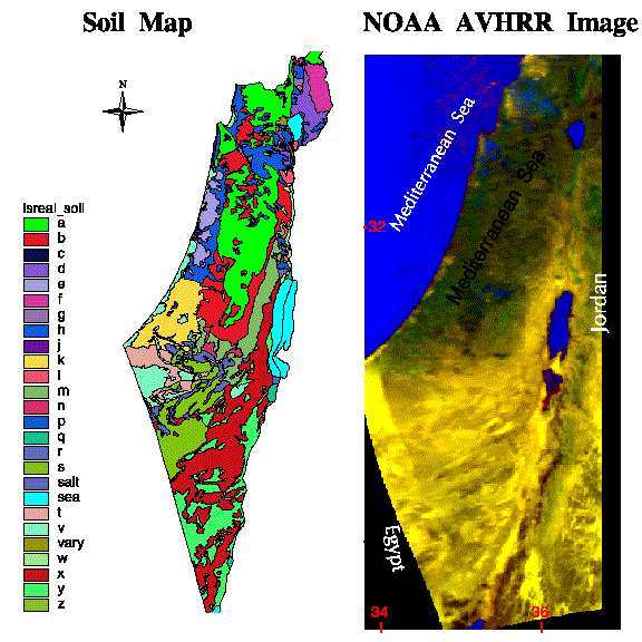
Soil Map and Satellite Image of IsraelThis is a soil map of Israel and The soil map is based on the classification of Israeli soils by Dan et al., 1977. See the legend to find descriptions of the letter-coded soil types. The satellite image is a georeferenced image from NOAA AVHRR sensors taken during winter. False colors were used to enhance vegetation (dark) with respect to the desert (yellow) areas, which makes it apparent that about half of the country is under arid conditions.
|
URL:http://cals.arizona.edu/OALS/soils/israel/soilmap.html
|