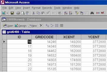
Although ArcView has the capability to link tables, in ArcView, you can only link tables with one field. We need to use MS ACCESS because the procedure involves linking two fields (x and y). Using x and y we can link the GeoEAS output to the ArcView grid shapefile ID field. Using the ID field the output can be linked to the shapefile in ArcView. The previous procedures show how to how to import into the MS ACCESS database (A) the output from GeoEAS and (B) the polygon attribute table from a matching ArcView shapefile. The first two columns in the GeoEAS output table are the x and y coordinates of the center of the grid cells used in the GeoEAS interpolation. The corresponding values (XCENT and YCENT) are found in the table from ArcView (in this case named grid6400) which contains the Id number of the grid cells in the polygon shapefile created in ArcView. This is the key to linking the files. [Note that for importing a dbf file to ACCESS, it is best to use just 8 letters in the file name (the old DOS 8.3 convention).] Below is an image of the grid6400 table in ACCESS.
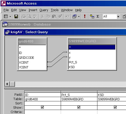
The next step is to use an ACCESS query to link
the XCENT and YCENT fields in the grid6400 table to the x and y field in
the S9899WEBGRD table. This type of linkage is not currently
possible in ArcView itself because it involves linking two fields (x and
y). In ArcView you can only link with one field, which in this case
will be the field labeled ID. The ACCESS query in design view looks
as follows:
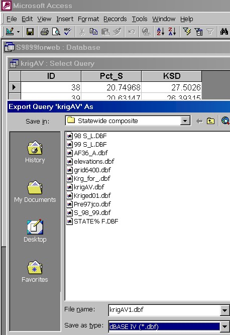
In table view, the result of the query is just three fields ID, the kriged estimate, and the KSD:
This table is now exported as a dbf file using ACCESS "Export" to an appropriate subdirectory from which it will be imported into ArcView for final linkage to the shapefile.
The ArcView procedure for linking to the shapefile will be shown on the next page. |
|
U of A Geostatistics | U of A Plant Pathology GIS Home | U of A GIS |