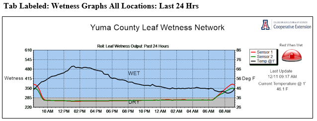
This is a new graphic for 2018/19 and provides a real time glimpse of wetness conditions for all five monitoring sites.
The alert light to the right of the wetness graph turns red when temperatures drop below freezing and thus provides a warning of potential frost/ice conditions.

This graphic summarizes wetness and near surface temperature conditions for the most recent 24 hours for each monitoring location.
There are two wetness sensors (red and green lines) at most locations. Dew or wetness from rain/irrigation is likely when sensor
readings move into the blue, wet zone of the graphic. The warning lights turn red when sensor readings indicate wetness. Temperatures
at produce height (1’ above surface) are indicated by the black line.

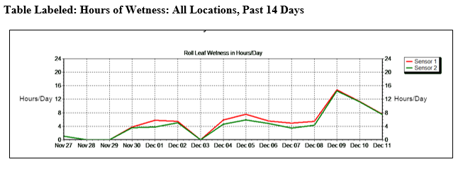
This graphic provides the number of hours of leaf wetness reported by the sensors at each location for the most recent 14 days.
Data from both sensors are reported and data are summarized for the 24 hours ending at midnight.

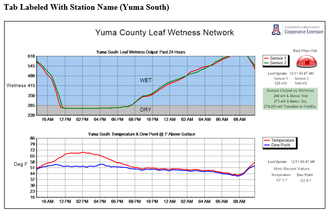
All data collected at a given leaf wetness monitoring station are provided in this graphic. The top panel provides the output
from the leaf wetness sensors for the past 24 hours. The second panel in the graphic provides a plot of temperature and dew point
at lettuce level (1’ above surface) for the past 24 hours. Wetness typically occurs when the difference between temperature and
dew point is less than 2 degrees. The final two panels (not shown) provide: 1) the relative humidity and wind speed over the past
24 hours and 2) the daily maximum, minimum and average dew point temperatures over the past 14 days.
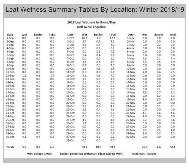
Tab Labeled Leaf Wetness Summary Tables
These tables summarize the leaf wetness data on a daily basis and will be updated about every two weeks. On most days with
wetness there are some periods when sensor output indicates a borderline wetness condition (column labeled Border). These
borderline periods typically are short and often occur after sunrise when the sensors are drying. The borderline values are
provided here to provide the worst-case scenario for wetness as indicated by the sensors.
