Step 0. An introduction to GIS, ArcView
projects, and basemaps.
Geographic information systems have the ability
to display layers of spatially referenced information. One of the
most useful applications in plant disease management work is the display
of point data as a layer over other layers showing background information
or baseline data. In the example below, the location of Aspergillus
flavus samples sites (black points) and interstate highways (red lines)
are layers ready to be placed on top of a map of Arizona showing the county
boundaries (polygons).

Combining the layers you get a map that looks
like this:

Information about GIS and sources of data for
base-map layers are widely available on the internet (see references).
In ArcView, all of the work is organized in a
Windows environment that is call a "project". Layers of spatially
referenced data are displayed as "Themes" in windows called a "Views".
Tabular data are displayed in windows called "Tables". An ArcView
project is saved as a ASCII file that organizes the geographic data
that you bring together in ArcView. ArcView project files have the extension
.apr attached to the file name. It is important to remember that
the geographic data (explained below) are not actually stored in the project
".apr" file. Instead, the ".apr" file contains pointers to the data
files using the DOS path name telling ArcView where the files are located.
When you open an existing ArcView project, ArcView gathers all the data
pointed to and displays the result on the computer screen.
Because ArcView projects contain pointers to data
files, in using ArcView, it is best not to move your geographic data files
to different locations (folders or subdirectories) on the hard drive, because
the pointers in the ArcView project files will not be able to find them.
It is very helpful to come up with an organization of your geographic data
into folders (subdirectories) that you are comfortable with and stick with
that organization.
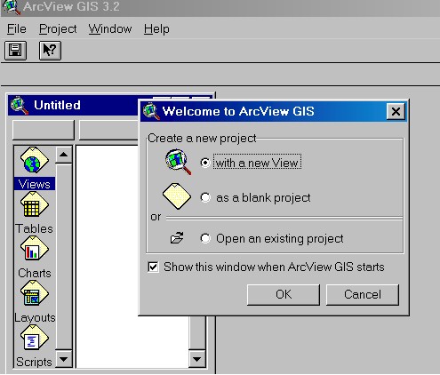
When ArcView is started from MS Windows by double
clicking on the ArcView icon, the ArcView project window appears.

Note that on the left panel is a list of five
types of documents that can be included in a project. We will be
primarily concerned with "Views" and with "Tables". For this example, choose
to create a new project as a blank project (or press cancel) which get
you to the same place.
We want to display our sample locations on a base
map showing roads, county boundaries, rivers, etc. The base map will
be displayed in a particular coordinate system. The goal is to have
a point map of our sample locations in the same coordinate system as the
base map. The first
step, therefore, in displaying a map of sample points, is to display
an appropriate base map.
For baseline data in Arizona, we use data from
The Arizona Land Resource Information System (ALRIS).
With ArcView 3.2, ESRI provides a set of five CD's with baseline data from
all over the world that we use for baseline data for areas outside of Arizona
(details).
Return
to opening page